
Earth Data, Made Intelligent
We turn satellite and Earth data into decision-grade intelligence, shaped to the way your team works.
Example use cases


CHANGE DETECTION
Automated change detection over any data type or area.
OPTICAL AREA MONITORING
Optical data is flexible: multi-spectral data for spotting hidden details, high resolution for human activity and more.
CONSTRUCTION TRACKING
Track the progress and conditions of ongoing construction.
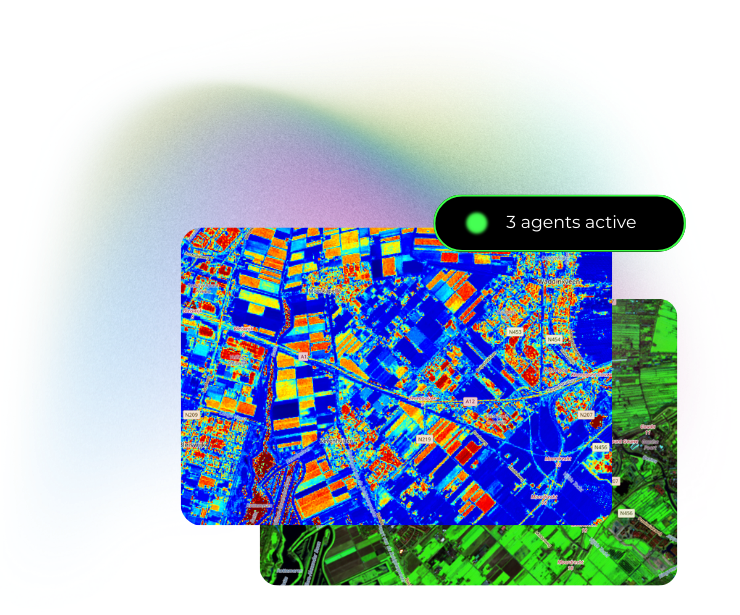
SURFACE TEMPERATURE MONITORING
Thermal signals can spot both natural and human activity that stays hidden in other spectra.
TOPOGRAPHICAL SITE ASSESSMENT
Assessments on high-resolution topographical data are crucial for site and project assessments.
Contains modified Copernicus Sentinel data (2026).
WHAT WE DELIVER
We turn satellite and Earth data into decision-grade intelligence about the places, assets, and events that matter to you. Get it as a dashboard, a notification, a report, or an API.
Assess
A decision-grade read on any asset.
Monitor
Continual tracking of changing parameters.
Respond
Rapid notification of or analysis after an event.
THE EARTH INTELLIGENCE COMPANY
Satellites watch the whole planet, every day. But turning what they see into decisions still depends on scarce human experts. That's why Earth intelligence has been expensive, slow, and out of reach for most of the people who need it.
Maiden Space exists to change that. We use proprietary AI technology to fuse satellite and Earth data from many sources and turn it into decision-grade analysis. It is delivered in the shape your work needs: a dashboard, a notification, a report, or an API. It is honest about what the data can and cannot show, and extends to new questions as they come.
FREQUENTLY ASKED QUESTIONS
What does the service deliver?
Decision-grade intelligence, in the shape your work needs: a dashboard, a notification, a report document, or an API. One-off analyses support development and event decisions (site assessment, screening, event response); standing coverage watches operating sites on a weekly or monthly cadence. Whatever the format, you get what has changed, the estimated impact, and recommended priorities.
Is satellite resolution sufficient for asset monitoring?
Satellite data provides site-scale coverage: vegetation, screening-grade soil, and change over time, for any site, with historical records from the satellite archive. It does not resolve centimeter-scale defects such as hairline cracks or cabling; defects at that scale remain the domain of on-site and drone inspection. Support for incorporating customer drone surveys and inspection records into the analysis is planned.
What resolution does the satellite data have?
Resolution varies by source. Pixel sizes range from 30 cm on commercial imagery to 10 m on public missions and kilometers on weather-scale sources; each provider offers a different combination of resolution and revisit frequency. We operate across multiple sources and data types, and support keeps growing. Specific imagery products can be incorporated on request.
How frequently is new data acquired?
Public sources revisit on a weekly basis; commercial sources daily. For high-value assets, multiple providers can be combined to achieve several acquisitions per day. We normalise and fuse the data regardless of the mix, and deliver findings at the level of detail the decision requires.
Is any on-site installation required?
No. The satellite tier requires no hardware, site visits, or software deployment, and satellite archives allow reporting on a site's history as well as its present condition.
What kinds of sites can be covered?
Any site tied to physical ground, from a single location to sites spread across regions. The platform is not limited to any one industry. Organisations with other monitoring requirements are invited to contact us.
Which sectors will benefit the most from Earth intelligence?
The sectors with the most business interest in the physical world. We expect these to be energy, infrastructure, logistics, finance, and insurance: they own, operate, finance, or underwrite assets whose value depends on conditions on the ground.
How does pricing work?
We quote custom projects by scope: their cost depends on data requirements, computation, and legal overhead. Contact us about your project as a whole to receive a quote. For standardised offerings, we are working on transparent, fixed pricing; we believe standardised, fixed-price products are the future of the space economy.
How does this relate to drone inspections?
The two are complementary. Satellite coverage is continuous and requires no mobilisation; drone surveys provide detail that satellites cannot. Our analysis indicates where further inspection is warranted, and support for incorporating drone data is planned.
How does this relate to expert analysis?
Some expert analyses will likely never be replaced by AI Earth intelligence alone. At our current level of technological maturity, our more complex analyses are fast and trustworthy, but they cannot yet fully replace experts on the most critical tasks. Our simpler analyses can, and we consider that a net positive: it unlocks use-cases and markets that expert studies could not serve economically.
If you use AI, how do you avoid hallucinations?
We use state-of-the-art techniques for building and evaluating AI harnesses, and we constrain the analytical tools available to our AI agents to human-written, verified code. The findings we deliver come from deterministic analysis, not from a model's free text.
What is the current development status?
Our core AI technology, Genesis, is currently for internal use only as it is in ongoing research and development. We are taking pilot projects, powered by Genesis.
Contact Us
Have a question or want to work together? Let's talk.
Address
Stationsplein 45 A4.0043013 AK Rotterdam
Message Sent!
Thank you for reaching out. You'll hear back soon!